Left Continue shopping
Your Order

You have no items in your cart

MSA Logo

MSA LUNAR

$3,74000
SKU: 10214747

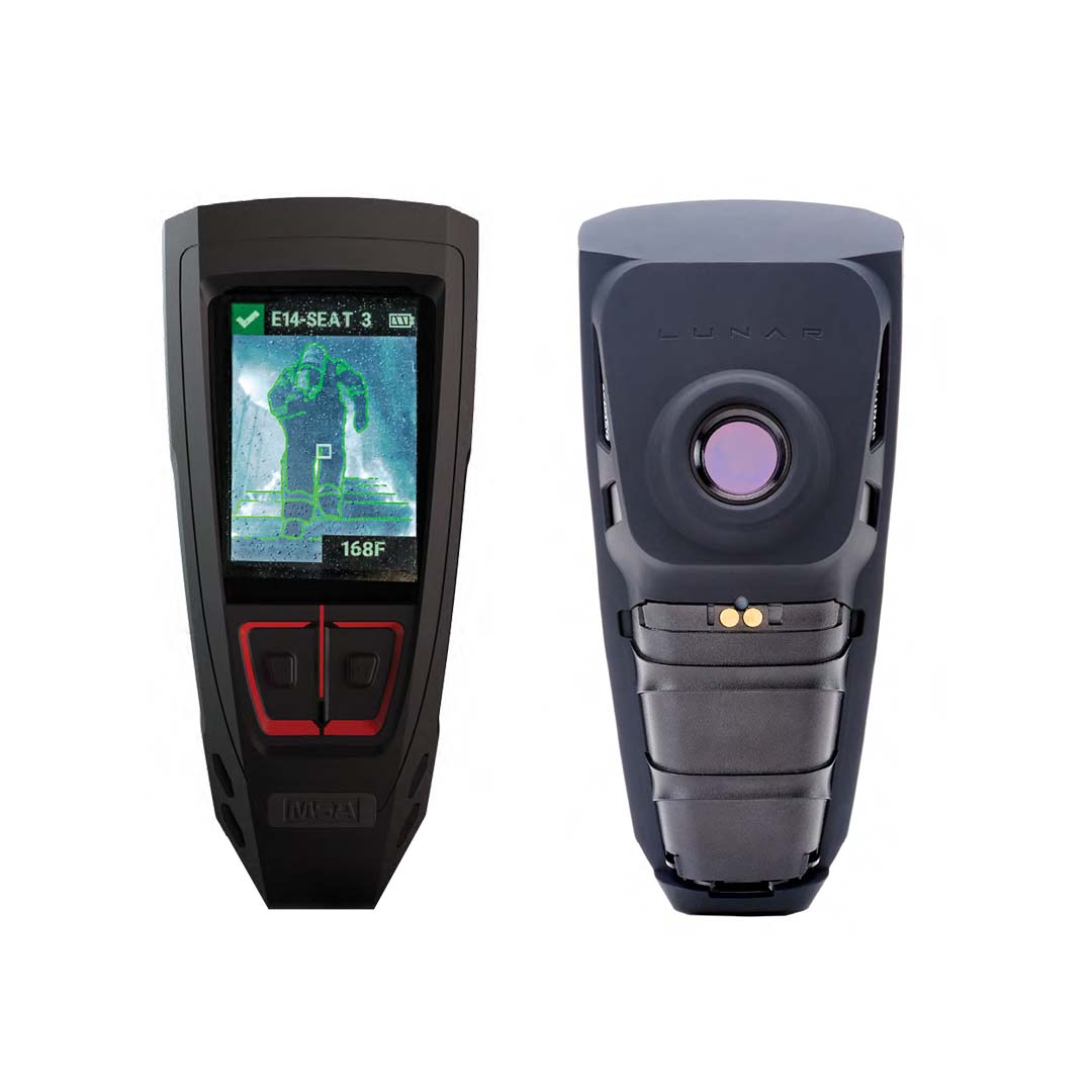
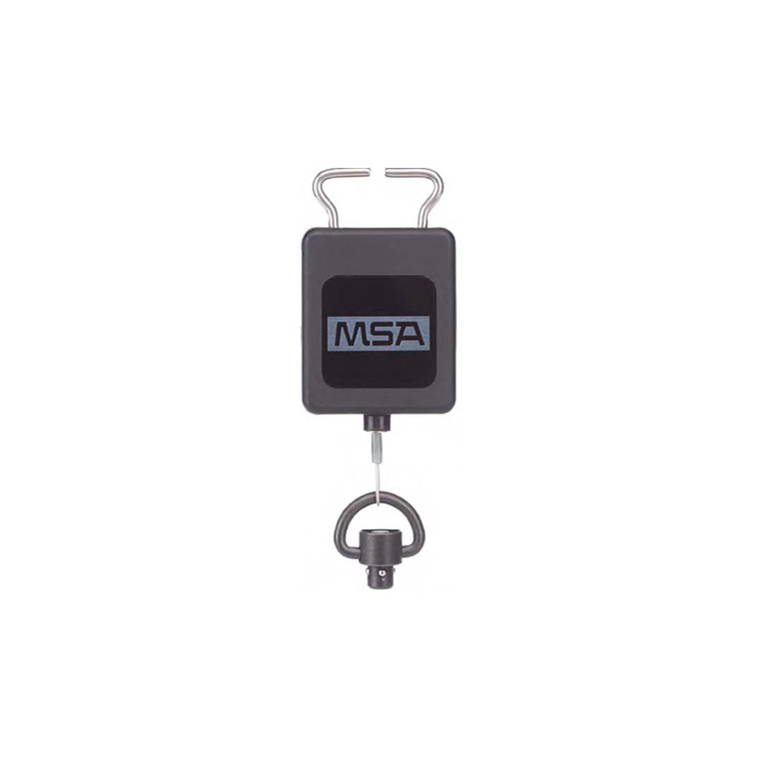
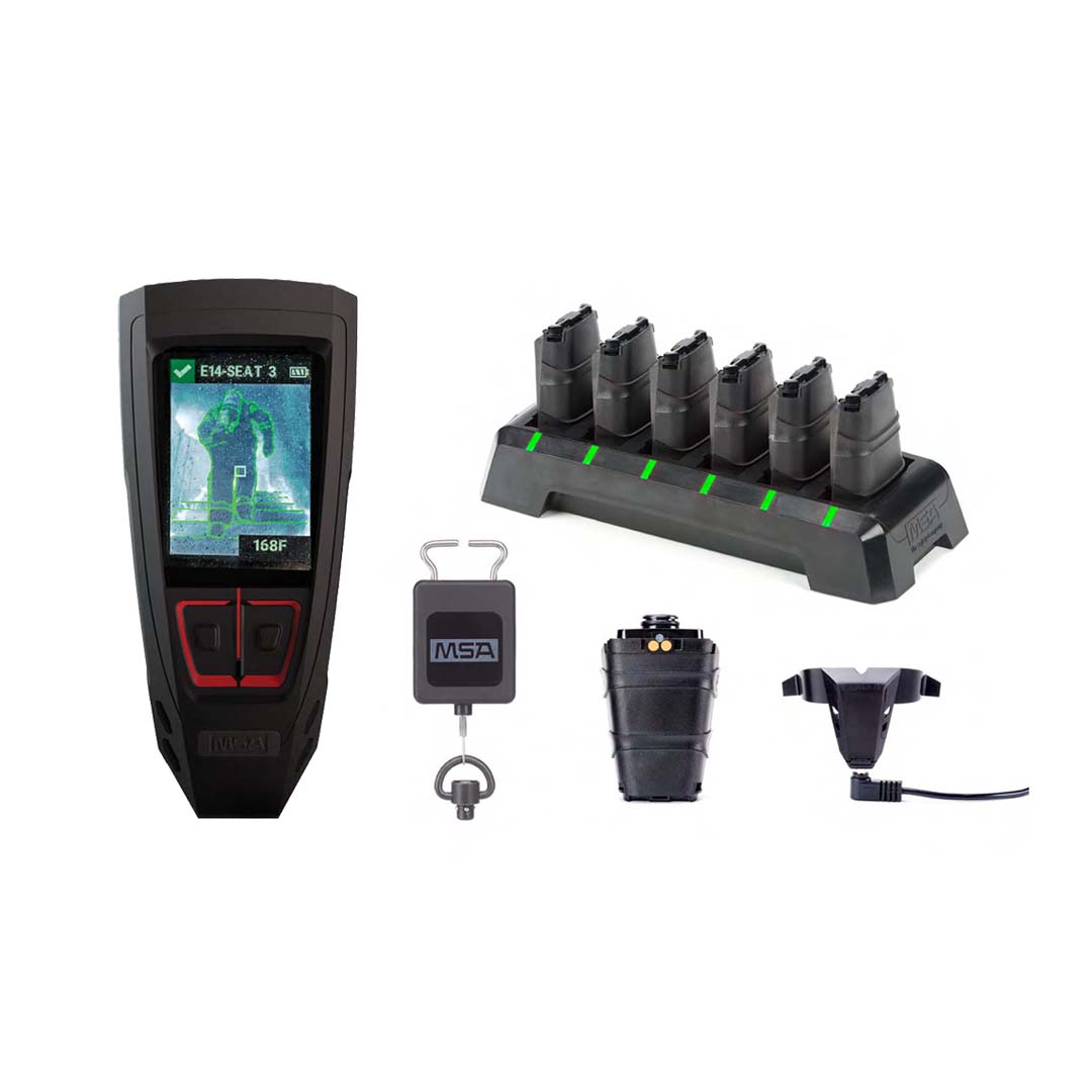
Resulting from years of working directly with Firefighters, LUNAR uses Cloud technology to deliver breakthrough fire-scene management capabilities for incident commanders. LUNAR can be used as a stand-alone device or as part of an MSA SCBA system.

Features

  • Firefighting Assisting Search Technology (FAST) combines distance and direction data enabling firefighters to locate separated teammates faster
  • Personal thermal imaging enhanced with edge detection for improved situational awareness
  • Direct cellular cloud connectivity to send real-time stats, including estimated air pressure, time remaining, and battery life, to Incident Command and remote monitoring personnel for a complete safety point-of-view
  • A unique LUNAR-to-LUNAR network that automatically keeps each device connected to all others on-scene

Technical Specs
Extended Information

A Changing World
View & Download PDF

Related PDFs

Connecting the Dots
View & Download PDF

Related Videos

MSA and Firegrid Logo

LUNAR IS PART OF THE MSA CONNECTED FIREFIGHTER PLATFORM

Living in a world that is increasingly connected, it's no surprise that this connectivity is extending to the fireground, in order to enhance the safety of firefighters in perilous situations. It's crucial for any technological advancements to align with established department traditions and standard operating procedures.

MSA's FireGrid offers a streamlined safety solution that complements and enhances these traditions. Through a suite of cloud-based applications, FireGrid provides access to both local and remote monitoring, reporting, maintenance, and inventory management. By transmitting real-time data, this technology enables improved situational awareness, empowering decision-making that is data-driven and confident.

GET THE RIGHT INFORMATION AT THE RIGHT TIME.

CLOUD-BASED CONNECTIVITY

The Connected Firefighter Platform is cloud-ready to transmit data to team members on-scene and remote, for improved connection, communication and confident decision-making and post-scene evaluation.

  • Device and incident data
  • Personnel and products on-scene
  • Inventory management including inspections and testing
  • Management of work orders and purchase orders

REAL-TIME INFORMATION

Effective fire-scene management requires real-time information for confident decision making. Knowing your entire crew is accounted for is critical to helping ensure their safety.

  • FireGrid MonitorĀ provides on-scene local monitoring with real-time search and rescue information; device statistics such as products on-scene and air pressure with estimated time remaining; issuance of evacuation alarms, alerts, warnings; and more.
  • Remote MonitoringĀ is a web-based, read-only monitoring solution to view multiple active incidents, including active firefighter count, connected devices, active alarms, incident duration, and search and rescue information.
  • FireGrid ConfigureĀ is a mobile application that supports quick configuration and personalization of devices by name, team, seat number, and department.

DATA-DRIVEN DECISIONS

Feel confident making decisions based on data from your team on the fireground. Incident and device reports, as well as data logs available for post-scene evaluation, provide insights for personnel training or for preventative maintenance to keep your products performing for the next call.

  • Automatic data generation and transmission to the cloud for storage
  • SCBA usage data
  • Post-scene processing for insights to fireground operations
  • Historical data for preventative maintenance

FIREGRIDā„¢ MAP VIEW

On-scene enhanced situational awareness with estimated location and status information of firefighters with LUNARā„¢ Connected Devices on a map.

  • Live monitoring for incident commanders and departmental leadership
  • Estimated location outside a structure
  • Selectable marker information – personalization
  • Status denoted by marker color
  • Last known location/GPS connection lost indication
  • Three selectable map views – satellite, default, terrain